On September 4, local time, the United Nations General Assembly passed the "Correct the Map" resolution with 164 votes in favor, 1 against, and 6 abstentions. The resolution encourages governments, educational institutions, international organizations, media, and tech platforms to use equal-area projections—such as Equal Earth—when presenting the relative sizes of regions on world maps. The United States was the sole vote against the draft.
At the heart of the debate is a centuries-old cartographic dilemma: how to represent a three-dimensional globe on a two-dimensional flat surface without distortion.
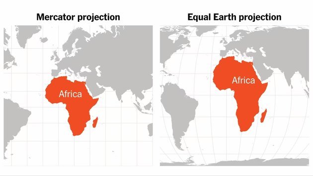
The 1569 Mercator projection served navigation well during the Age of Discovery, but severely exaggerates high-latitude regions on a global scale. In 2018, American cartographer Tom Patterson, along with his colleagues, created the Equal Earth projection to preserve accurate land area proportions while maintaining visually pleasing continental outlines.
In an exclusive interview with National Business Daily (NBD), Tom Patterson, retired senior cartographer at the U.S. National Park Service, discussed the origin of Equal Earth, the controversy surrounding Mercator, and why interactive map services like Google and Apple have already found the ideal balance.
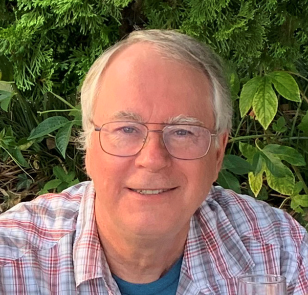
Tom Patterson Photo/Provided to NBD
Equal Earth Was Built to Improve Equal-Area Maps, Not to Replace Mercator
The recent UN vote has led some to believe Equal Earth was designed specifically to eliminate the Mercator projection. In reality, its immediate trigger was the decision by Boston Public Schools in 2017 to adopt the Gall-Peters projection, an equal-area map that preserves correct area proportions but severely distorts continental shapes along the north-south axis. Released in 2018, Equal Earth was created as a visually pleasing alternative.
NBD: After Boston Public Schools announced in 2017 that it would adopt the Gall-Peters projection, you began looking for a better equal-area alternative. What convinced you at the time that existing world map projections were not sufficient, and that a new one was worth creating?
Tom Patterson: Actually, other equal area projections were available, such Eckert IV and Mollweide, but they never became as popular as Gall-Peters projection, which had been actively promoted since the 1970s and many well-meaning organizations adopted it, such as Boston Public Schools. The problem with Gall-Peters is how it distorts continent shapes—they are very stretched on the north-south axis. Our aim with Equal Earth was to create a new projection that was both equal-area and pleasing to the eye."
NBD: When Equal Earth was introduced in 2018, it was primarily a cartographic and educational innovation. Eight years later, it has become part of a United Nations debate over Africa. Did you ever imagine that the projection would take on this kind of significance?
Tom Patterson: Not at all. My hope for the new map was to have it accepted and used regularly by professional cartographers, who are relatively few in number. That is what happened initially after introducing it in 2018. But a few years later a group in Africa discovered Equal Earth and launched "Correct the Map" an online campaign that eventually led to the UN vote. I am most grateful for their support.
Mercator Is Poor for World Maps, but Superior for Local Streets
NBD: Many recent reports describe Mercator as a "wrong" or "distorted" world map. What do you think of it?
Tom Patterson: World maps in the Mercator projection are obviously not good because of how they exaggerate the size of northern lands, although it was an excellent tool for navigation in the days of sail. The good news is that since the mid-twentieth century relatively few world maps have used that projection.
Nevertheless, the Mercator projection has been often referred to it as the "standard" map. Cartography long ago moved on, but popular opinion has not.
NBD: Equal Earth preserves true relative sizes, but what is it best suited for, and where should it not be used?
Tom Patterson: Equal Earth was solely designed for maps of the entire world on walls, books, and computer screens. It does a poor job depicting large-scale areas, such as streets in cities. The Mercator projection is a much better choice for city maps because it preserves shapes accurately at large scales. Google, Apple, Bing and other online mapping services use the Mercator projection for close-in mapping.
NBD: Should online mapping platforms reduce their reliance on Mercator?
Tom Patterson: Apple and Google maps employ the ideal map projection solution: When zoomed in, they use the Mercator, and when zoomed out the map transitions to a globe, thus avoiding the problem of depicting a spherical object, Earth, as a flat graphic.
Maps Shape Perceptions in the Global South
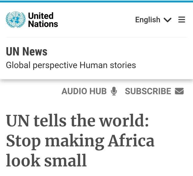
NBD: Supporters argue that visually shrinking Africa affects how people perceive its population and economic weight. What do you make of it?
Tom Patterson: Perceptions matter, especially for students in Africa and elsewhere in the global south who, with the Equal Earth map, can now see their place in the world—accurately. Having said that, I have not seen research that measures the influence of maps on political or economic perceptions."
NBD: The United States was the only country to vote against the UN resolution, arguing that the initiative was ideologically driven. How do you view this development?
Tom Patterson: Although I eschew politics as much as possible, I am pleased that others who are "socially conscious" have used Equal Earth as a tool to represent our home planet in what they perceive as a fair way. My role in creating Equal Earth was technical; I'll leave it to others to interpret the map as they wish.
NBD: The UN resolution encourages schools, media, and tech platforms to use equal-area maps more widely. Which of these should change first?
Tom Patterson: For world maps used in schools, a strong case can be made for relative proportionality. But maps are used for a multitude of purposes and there are hundreds of different map projections with specific properties. It is up to the cartographer to select the best one depending on the use case. One size does not fit all.
Editor’s note: The interview has been reordered and lightly edited for clarity and written presentation, without altering the substance of the responses.


 川公网安备 51019002001991号